Build with ultimate flexibility
Add navigation features with ready-made components or build custom for specific needs or analysis.
Optimal routing at scale
Mapbox Navigation APIs process 29 million requests for directions, routes, and travel time estimates every day.
Live AI-powered data
Mapbox data pipelines process over 400 billion live location updates and 300 million miles of sensor data daily.
Navigation SDK
Design a personalized navigation experience for any device or platform. Maintain full control over your app experience and brand identity by embedding navigation directly into your product. Smoothly transition users into a rich turn-by-turn navigation journey, while engaging them with custom data and visualizations.
Navigation APIs
Build navigation experiences with modular APIs or crunch the numbers on travel time and optimal routes. Scale up to millions of origin and destination possibilities for optimization of fleets, delivery services, or distribution networks.
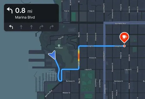
Plan and optimize routes
Calculate optimal driving, walking, and cycling routes with the Mapbox Directions API. Add turn-by-turn directions and account for live or typical traffic conditions.
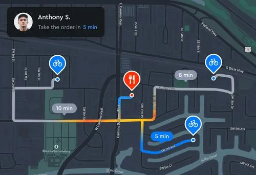
Traffic-aware ETA calculations
Improve travel time planning with the Mapbox Matrix API, whether for a short list of destinations or fleet planning at scale. Account for traffic conditions and departure times.
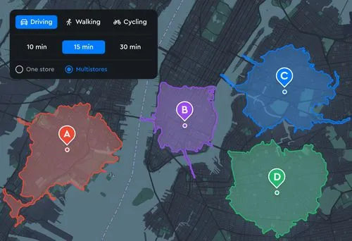
Visualize travel time
Get granular with travel time polygons that account for the road network, transportation profile, and traffic conditions with the Mapbox Isochrone API. Use the polygons for catchment analysis, distribution planning, site selection, and more.
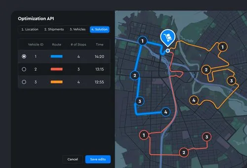
Optimize routes for a fleet
Solve vehicle routing problems for multiple vehicles and destinations with the Mapbox Optimization API. Designed for fleet logistics, allow for time window constraints, vehicle capacity limits, driver shifts, and pickup and drop-off constraints.
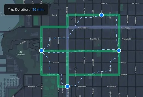
Stick to the roads
Make sure traces from a GPS unit or smartphone align to the road network on maps with the Mapbox Map Matching API. Allow users to create their own travel routes that can still be ingested by navigation functions.
Customer stories

With GM Maps+ over a million Chevrolet, Buick, GMC and Cadillac vehicles can now access a real-time, integrated navigation app that updates over time, using Mapbox Navigation solutions for automotive.
Read showcase →

Mapbox Navigation APIs help Instacart to plan and group deliveries, find nearby shoppers, and deliver orders on time. The Mapbox Directions API ensures that Instacart drivers get the most efficient routes, while the Map Matching API matches live tracking data to the road network.
Read showcase →

The Royal Dutch Touring Club helps their 5 million members navigate with their award-winning Onderweg app. Mapbox Navigation solutions for mobile enable route planning and turn-by-turn directions that delight users with a tailor-made in-app experience.
Read showcase →
What's new with Navigation
Navigation Products
A comprehensive suite of products to power navigation features in mobile, web, and automotive applications.
Navigation SDK for automotive
Custom navigation for an immersive in vehicle experience.
Navigation SDK for mobile
Embed navigation into your mobile applications.
Mapbox for EV
Plan routes, predict battery range, discover charge points, and pay for charging.
MapGPT
Navigation support via a customizable location-aware AI voice assistant.
Directions API
Calculate optimal driving, walking, and cycling routes with turn-by-turn guidance.
Matrix API
Assess travel times between many origin and destination points, live or in the future.
Isochrone API
Compute areas that are reachable within a specified amount of time from a location.
Optimization API
Plan routes for pick-ups, deliveries, and fleet logistics.
Map matching API
Snap fuzzy or inaccurate traces from a GPS unit or a phone to the road network.
Frequently asked questions
Overview
The Navigation SDK empowers developers to create a custom navigation experience directly within their applications, enabling them to strengthen their app’s user experience and brand identity while leveraging all the power of the Mapbox Navigation APIs and Geospatial Data Platform.
This SDK facilitates the creation of navigation services by offering functionalities like an embedded routing engine, Mapbox 3D Standard map styling, navigation camera, enhanced arrival experiences with building highlights, and predictive caching.
You can now create a modern 3D Navigation experience within your application. The release adds a runtime infrastructure that increases the smoothness and reliability of navigation. Live traffic layer included with Mapbox Standard Style.
Mapbox Standard refers to a default map style, which is designed to provide a visually appealing and detailed representation of the digital world with 3D visualizations. It includes rich details like custom landmark buildings, dynamic lighting, and environmental effects such as fog and depth of field, enhancing the map's realism and user experience. Mapbox Standard is part of the Mapbox GL JS v3 and Mobile Maps SDKs v11 (as part of the Navigation SDK), and can be styled it is accessible through Mapbox Studio.
Mapbox Live Traffic is the most accurate and visually alive traffic service offered by Mapbox. This live traffic layer is included with Mapbox Standard style integration with implementations of the Navigation SDK.
Navigation SDK v2.0
On Android, it supports Android 5.0 Lollipop (API Level 21) and above, and on iOS, it supports iOS 11.0 and above.
Navigation SDK v1.0
On Android, it supports Android 4.4 KitKat (API Level 19) and above, and on iOS, it supports iOS 10.0 and above.
The Mapbox Navigation SDK provides core functionality out of the box along with easy to follow examples to set up your experience in just a few hours. The SDK also provides UI components that help you build this core experience quickly to include turn by turn guidance, route line rendering, navigation camera controls, offline guidance, voice instructions, banner instructions, speed limit visual, trip progress, arrival detection, and more.
The Mapbox Navigation platform enables developers to further customize their experience by incorporating custom features, visual elements, and additional data.
To get started, please refer to these pages for the iOS and Android SDK solutions.
Yes. You are able to create and send your own route with the SDK. There are two flavors of this option that is known as Bring Your Own Route (BYOR). The first one is known as Map Matching in which you can create an entire route with every waypoint lat/long along the entire length of the route, including guidance information, from just a list of coordinates or OpenLR source. Once these waypoints are sent to the Navigation SDK, Mapbox will merely create a route from these location points and return a completed route back to the client. From here, the map will be refreshed with traffic and incident data, but the original route will not be updated based on changing conditions. If a driver goes off course, your routing engine will need to handle any necessary re-routing.
The second method is called Silent Waypoints. This is similar to Map Matching, but only a few waypoints are provided to the Mapbox SDK along the path. Mapbox’s Directions API routing engine will then optimize for the points the user should drive through. In this scenario, route refresh can occur if an incident occurs along the path as long as all as waypoints are preserved. This option allows for a semi-customized route with the benefit of rerouting being handled by the Navigation SDK.
There is a limitation of 25 way points but this is configurable and can be increased.
Yes, when using the Navigation SDK, a default Navigation style that extends Mapbox Standard brings 3D landmarks to the map. Buildings can behighlighted upon arrival, helping drivers arrive faster and spend less time looking for the right building. Navigation SDK v3 support is expected later this year.
Including turn-by-turn navigation directly in an application allows developers to create a tailored experience that caters to their users' specific needs. Apps can embed and control navigation as part of the user's overall workflow, enriching it with domain-specific information.
1. Customize navigation: developers can personalize the navigation experience for different use cases and audiences: display parking and doorsteps for delivery drivers, EV charging for electric vehicles, meal or beverage promotions for travelers. Bring your own data to further enrich the experience for your users.
2. Streamline workflows: developers have full control over the turn-by-turn workflow allowing smooth mid-trip adjustments like adding additional pickup/dropoff waypoints in real-time for drivers.
3. Keep drivers in-app: developers can enhance the driver experience end-to-end, collecting metrics and identifying opportunities to improve workflows.
4. Data on User Behavior: Collecting metrics on actual driver behavior provides the ability to understand how end users are interacting with the application. Insights collected from this data can continue to add future improvements to the application including monetization opportunities.
Navigation needs enhanced locations to correctly determine a user’s location and give the appropriate instructions during navigation. We have designed the enhanced location engine to filter GPS signals and snap the vehicle onto the relevant road segments. This helps to prevent deviation or gliding, such as cutting corners at an intersection.
Low or complete loss of GPS signal
- Routing in tunnels
- Routing in a city through tall buildings from both sides with both narrow and wide streets, i.e. urban canyon
Driving with deviations from the route under various conditions
- Going straight instead of turning (left, right)
- Turning instead of going straight
- Taking a highway exit where we should go straight
Complex road intersections and interchanges
- Taking an off-route highway exit on a parallel road on a lower level next to the highway and continuing to drive along the highway
- Routing on highways where we transition from lower level to elevated level and back to a lower level
The map is updated every 24 hours based on the data derived from the +300 million miles of driving data collected each day. Mapbox APIs stream data updates for maps, search, and routing to the Navigation SDK. The automatic updates and live correction pipeline marks newly opened or closed roads or changes in routing conditions as they happen.
Yes. Traffic updates at near real-time granularity for 30 billion roads segments around the world. The hundreds of millions of monthly active users using Mapbox maps on devices and in vehicles create a data feedback cycle. Mapbox data pipelines process hundreds of millions of miles of aggregated, anonymized and privacy-filtered driving data daily to provide continuously updated traffic on the map everywhere in the world.
While Mapbox doesn’t directly provide wrappers for these libraries, there are community groups that we support in maintaining these.
UI/UX Customization
Yes. The Navigation SDK allows developers to add in-app turn-by-turn navigation by providing UI components, core navigation logic, and APIs that provide a map, a route on the map, and trip progress without the need to upkeep the underlying data or algorithms.
The Mapbox Navigation SDK features include live traffic maps, turn-by-turn directions, detailed visual guidance, audio instructions for complex maneuvers, enhanced location engine for dense urban environments with poor GPS, route tracking, and re-route management to display real-time progress along a route, and offline caching.
Legacy Nav SDK versions (before v3.0.0)
Pricing
Developers have two different pricing options for the Navigation SDK, 1) Unlimited trip MAU based (contract required) and 2) Metered trip pricing. The flexible pricing options allow everyone to choose the billing format that best suits their needs. The latest pricing is available on the pricing page.
Mapbox Live Traffic Tileset is available at no extra cost with Mapbox Standard Style. Map Matching APIs are included with the Navigation SDK pricing.
The Metered trip billing option is set as the default for the Navigation SDK. If you are interested in the Unlimited MAU option, please reach out to our sales team.
Developers must use the Nav SDK v2.0.0-rc.1 or newer so they can access the per trip pricing option. Prior versions only have access to the Unlimited trip MAU billing option.
Yes. The new billing is a pay-as-you-go pricing method that requires no upfront commitments or annual contracts.
Yes. It includes Directions and Maps API requests along with map matching for the Bring Your Own Route approach, which powers the navigation SDK’s functionality. API calls for use cases outside of navigation will be billed at their corresponding prices. Developers who wish to use Directions API-based billing may still do so by calling the APIs directly from within their apps.
Customers are free to select any billing option for the Nav SDK that they choose. The unlimited trip MAU option is intended for users that do more than 200 trips per month on average. The per trip option is intended for users that do less than 50 trips per month. A link to the full pricing page can be found here.
Miscellaneous
By default, OSM data is used for Navigation as there is a separate contract with Zenrin for the Navigation SDK use case. Please check with Mapbox Support when Zenrin’s Japan Navigation is needed. There will be separate pricing in this use case. Visual Map is always Zenrin. Only the routing map uses OSM.
In addition to Zenrin Premium data pricing, additional costs for Highway Toll Pricing and JARTIC J-System per user pricing is needed.
No, for Japan use case the new pricing for Japan usage will need to be created which uses Zenrin Navigation backend. By default, Navigation SDK will serve Zenrin maps but still uses OSM routing.
No, the road network does not get updated as Japan uses Zenrin as a base map. Zenrin maps are updated every 2 months, with 3 to 4 months old data. These time lags for major road openings are compensated through the “pre-opened roads” system, where Mapbox Japan teams manually add road opening dates to major road systems flagged by Zenrin.
Yes and no. Traffic can be available from Mapbox Live traffic. Incident information will need to come from JARTIC’s J-System data which requires additional license costs. J-System Traffic and incidents will be available later half of 2022. More on it in this doc.
No, VICS data is not available in Japan at the moment and we do not have this in our roadmap due to export restrictions.
Maps v10 is embedded into Nav 2.0 and the older version of Maps SDK is incompatible with Nav v2. For users that are using a combination of pre v10 Maps SDK and 3rd party Navigation API, migration will need to happen for any Map SDK related functions.
Electric vehicle routing
Mapbox EV Routing is available in private preview via Directions API. To learn more, read the API documentation.
For pricing and accessing EV routing, reach out to Mapbox Sales.
Finding the best route for a given live road condition is not enough to meet the expectations of the EV auto market. Mapbox EV routing requires bringing together live location data, EV charging station data, and vehicle characteristics into a unified solution. Companies doing it in-house incur high costs and several months of engineering time to bring the feature to life. Mapbox customers can upgrade to EV routing within the car infotainment almost instantly, delivering a premium navigation experience that attracts more drivers to the EV market, accelerating the transition to electric.
Automakers get access to ever improving live updates, lowering automaker’s engineering investments in the future. This includes 100K daily map updates and regular updates to charging station data. Mapbox’s proprietary charger graph enables quick API response time and as new chargers are continually installed, Mapbox refreshes the charger graph to provide developers with up-to-date charging options. Developers can customize the API to any model of Electric Vehicle with programmable vehicle characteristics.
Electric Vehicle Routing is a new routing feature in private preview as part of Mapbox Directions API, enabling automakers to build smarter EVs that are easier to use and app developers to create intelligent navigation apps that accelerate the transition to electric. It enables automatic EV trip planning, range assurance and low battery alerts.
Developers can define the static and dynamic characteristics of the electric vehicle such as battery level, consumption curve, and charger compatibility to generate routes that get drivers to their destination with the optimal charging stops as well as get precise battery prediction for the trip. Mapbox EV Routing can be added to in-car navigation systems and apps for mobile and web.
Please contact Mapbox Sales if you are interested in Navigation SDK with EV Routing.
EV Routing can be customized for most EV models by programmable parameters. These parameters represent the battery characteristics and vehicle dynamics and should be provided at the time of API request.
For a list of parameters, see API documentation.
For a list of geographies supported, see API documentation.
Please contact Mapbox Sales if you are interested in geography not listed above.
In case there are no high power charging stations available, the trip planning will fall back to slower charging stations.
Mapbox EV Router uses Open Charge Map (OCM), a non-commercial, non-profit, electric vehicle data service hosted and supported by a community of businesses, charities, developers and interested parties around the world. Mapbox EV router processes charging station data from OCM and builds a digital graph of interconnected stations. When an EV route request is made, the router will pick up the nearest stations along the route and identify the fastest chargers that are compatible with the driver’s model of EV.
No, EV Routing is currently supporting only Battery Electric Vehicles.
For pricing, contact Mapbox Sales.




%202-p-500.webp)
-p-500.webp)